Beginning to Map Public Water Infrastructures of Aluru Gram Panchayat
Maintainer-Repairer: Adhavan Sivaraj.
Co-authors: Vidya HP, Sangeetha Rajapandian, Naveen Bagalkot.
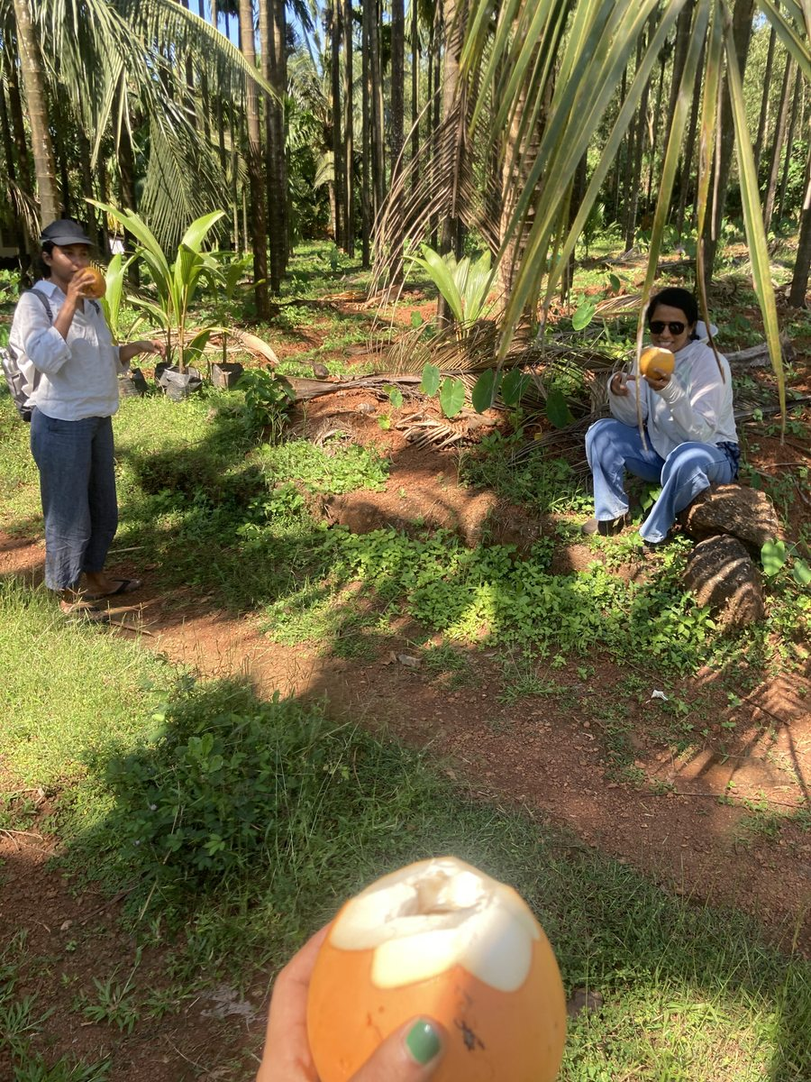
On a hot and humid afternoon on the 14th of October 2025, we found ourselves sitting in the office of Rajesh Devadiga the president of Aluru Grama Panchayat (GP) sharing our ideas for participatory geospatial mapping in the Aluru GP area. On Open Street Maps (OSM), Adhavan S had mapped agricultural fields and houses, Vivek Mathew had mapped reserve forest areas and Ayush K was in the field mapping public buildings such as the GP office, Post Office, Primary Health Center, Government Schools, Anganwadi, etc.
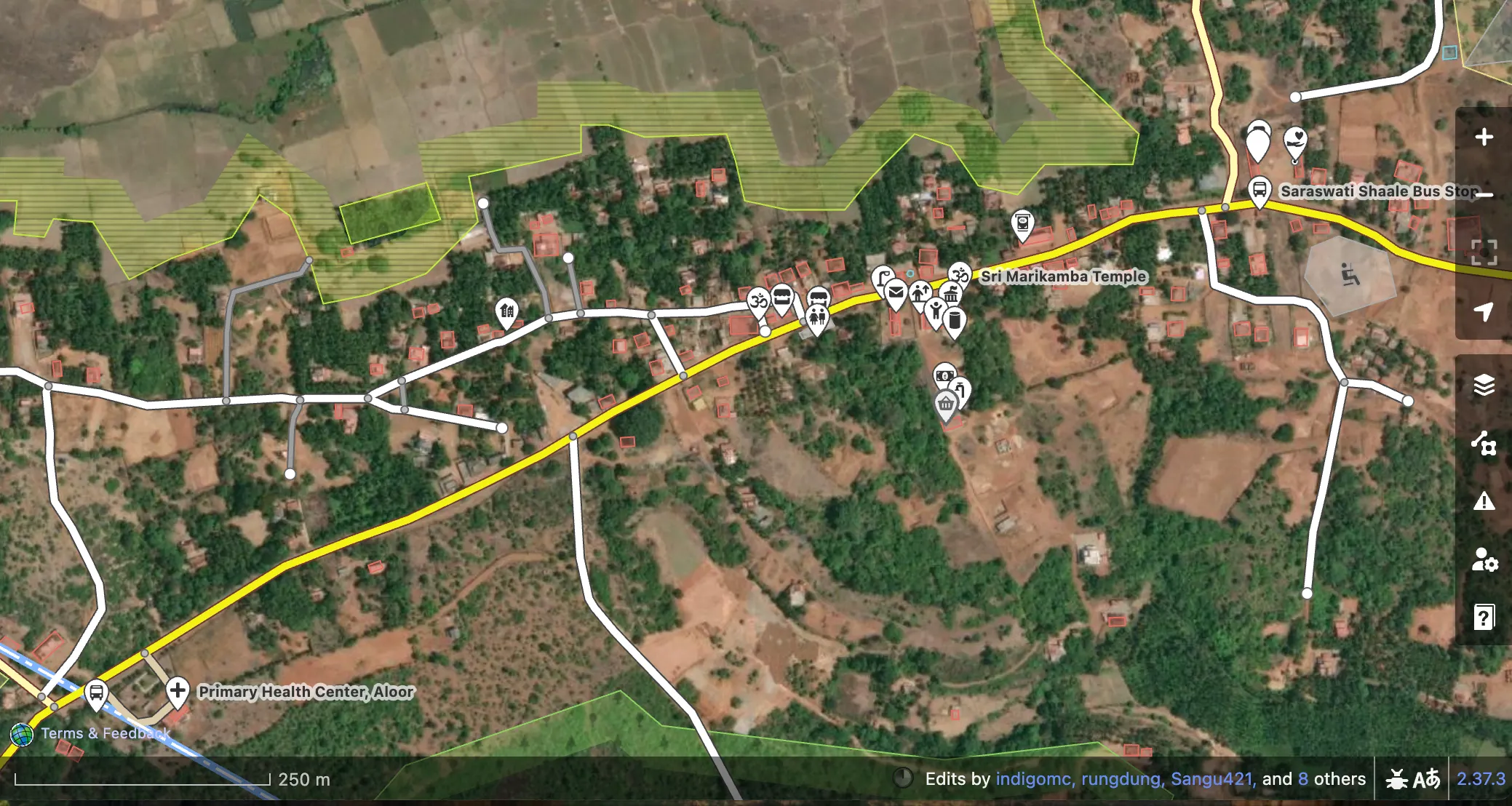
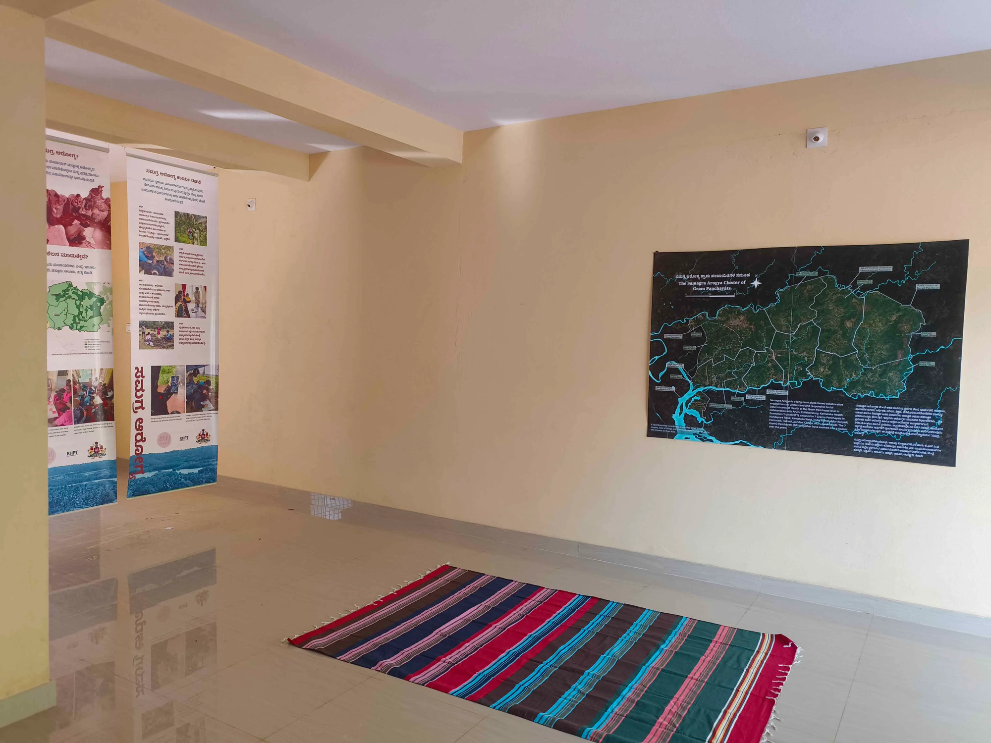
Rajesh had seen the map of the seven gram panchayats digitally made by Adhavan and put up in the Samagra Arogya Resource Center, and wanted us to make something similar for Aluru. “Can you map the points of Sowparnika Lift Irrigation Scheme? It will be good for us to know where the water flows at different points of time.” Rajesh asked us. Later he took us to the under-construction new GP office building, and pointing to a blank wall space, said “That wall is all yours. For the Aluru map.”
Water Governance of Aluru Panchyat.
Our focus on the two days of November 5 and 6th was to get a glimmer of understanding of the water systems of Aluru Panchayat through mapping. We began the day with conversations with, what turned out to be the key members of the ಗ್ರಾಮ ನೀರು ಮತ್ತು ನೈರ್ಮಲ್ಯ ಸಮಿತಿ (Village Water and Sanitation Committee - VWSC) of Aluru and Harkuru, the two villages of the GP. We learned through the conversations before, during and after mapping that the VWSCs oversee the planning, utilising the funding (allotted from the yearly GP budget), and maintenance of the GP controlled water systems. They also negotiate with the forest department and irrigation departments for periodic water releases based on the need of the population.
Aluru VWSC consists of
- Rajesh N Devadiga- President
- Singari- Vice President
- Subbanna Shetty- Member
- Raghavedra Poojary- member
- Ravi Shetty- member
- Srimathi Poojary-member
- Gange Shedthi-member
- Jalaja Shedthi-member
- Asha (Akkayya)-member
- Prabhakar Poojary-member
- Prashanth Kulal-member
Harkuru VWSC consists of
- Sudhakar Shetty-President
- Jayalxmi-member
- Rajendra Devadiga-member
- Pramod K Shetty-member
- Prasanna Kumar Shetty-member
- Dinesh Devadiga-member
- Manjula-member
- Muttu Devadiga-member
- Sadashiva Acharya-member
- Roopa Gopi- member secretary
During our conversations with Rajesh on the morning of the 6th November, he mentioned that both the VWSCs are allotted an annual budget from the GP budget for new projects, maintenance and salaries (of water-men, etc). This amount is decided in the Samanya Sabhe that is dedicated for annual budgeting by all the GP members. For the year 2025-26, the amount budgeted is 9,97,377 INR for both the VWSCs.
Water Systems of Aluru Panchayat
ನಮ್ಮ ಮ್ಯಾಪಿಂಗ್ ಮೂಲಕ ಆಲೂರಿನ ನೀರಿನ ಮೂಲಗಳು, ಹಾಗೂ ನೀರಿಗೆ ಸಂಬಂಧಿಸಿದ ವಿಷಯಗಳಲ್ಲಿ ಪಂಚಾಯತ್ ಜವಬ್ದಾರಿಗಳ ಬಗ್ಗೆ ಅಧ್ಯಯನ ಆರಂಭಿಸಿದಾಗ ನಮ್ಮನ್ನು ಸೆಳೆದ ಮೊದಲ ವಿಚಾರವೆನೆಂದರೆ ಇಂತಹ ಪಾರೆ ಪ್ರದೇಶಗಳಿರುವ ಜಾಗದಲ್ಲಿ ಬೇಸಿಗೆ ಸಮಯದಲ್ಲಿ ನೀರಿನ ಅಭಾವವಿರುವ ಪ್ರದೇಶಗಳಲ್ಲಿ ನಡೆಯುತ್ತಿರುವ ಕೃಷಿ ಹಾಘೂ ತೋಟಗಾರಿಕೆ. ಅದಕ್ಕೆ ಉತ್ತರ ಸಿಕ್ಕಿದ್ದು ಪಂಚಾಯತ್ ಅಧ್ಯಕ್ಷರಾದ ರಾಜೇಶ್ ಅವರಿಂದ. ಸೂಮಾರು 2008 ರಲ್ಲಿ ಸೌಪರ್ಣಿಕ ಯೆತ ಯೋಜನೆ ನೀರಿನ ಅಭಾವಕ್ಕೆ ಪರಿಹಾರವಾಗಿ ಆರಂಭಗೊಂಡ ಯೋಜನೆ. ಈ ಯೋಜನೆ ಅಡಿಯಲ್ಲಿ ಆಲೂರು ಗ್ರಾಮ ಪಂಚಾಯತ್ ವ್ಯಾಪ್ತಿಯಲ್ಲಿಯೇ ಸೂಮಾರು 19 ಚೆಕ್ ಡ್ಯಾಂಗಳು ಇದ್ದು, ಈ ಸೌಪರ್ಣಿಕ ನೀರಿನ ಕಾಲುವೆಗಳು ಹೆಚ್ಚಿನ ತೋಟ, ಗದ್ದೆಗಳನ್ನು ಹಾದು ಹೋಗಿರುವುದರಿಂದ ಅಂತರ್ಜಲ ಮಟ್ಟವು ಹೆಚ್ಚಾಗಿ ಊರಿನ ಬಾವಿ, ಕರೆಗಳಲ್ಲಿಯೂ ವರ್ಷದ ಹೆಚ್ಚಿನ ಸಮಯದಲ್ಲಿ ನೀರಿನಿಂದ ತುಂಬಿರುತ್ತದೆ.
Through conversations with some of the members of both the Aluru and Harkuru VWSC, namely Rajesh Devadiga, Ravi Shetty, Prashanth Kulal and Prasanna Shetty, we listed the different water systems that concerns Aluru Panchayat.
Public Irrigation Infrastructure
Irrigation is designed and implemented by the State Irrigation departments and their initiatives, and the Panchayat through the VWSC negotiates with the Project Engineers for release of water based on the seasonal as well as emergent needs. Irrigation systems are of two kinds:
- Varahi Lift Irrigation (ಏತ ನೀರಾವರಿ) Project, under which the Sowparnika Lift Irrigation Scheme is implement. The different assets under this project are:
- Pump house, Lift point, Pipelines, ತೋಡ್ Thod (natural and human made water surface level channels), 19 check-dams in Aluru Panchayat, and Kere (natural and human made holding ponds)
- Minor Irrigation Department (ಸಣ್ಣ ನೀರಾವರಿ ಇಲಾಖೆ): Minor Irrigation Check-Dams
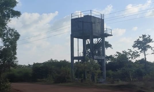
Drinking / Potable Water Infrastructure
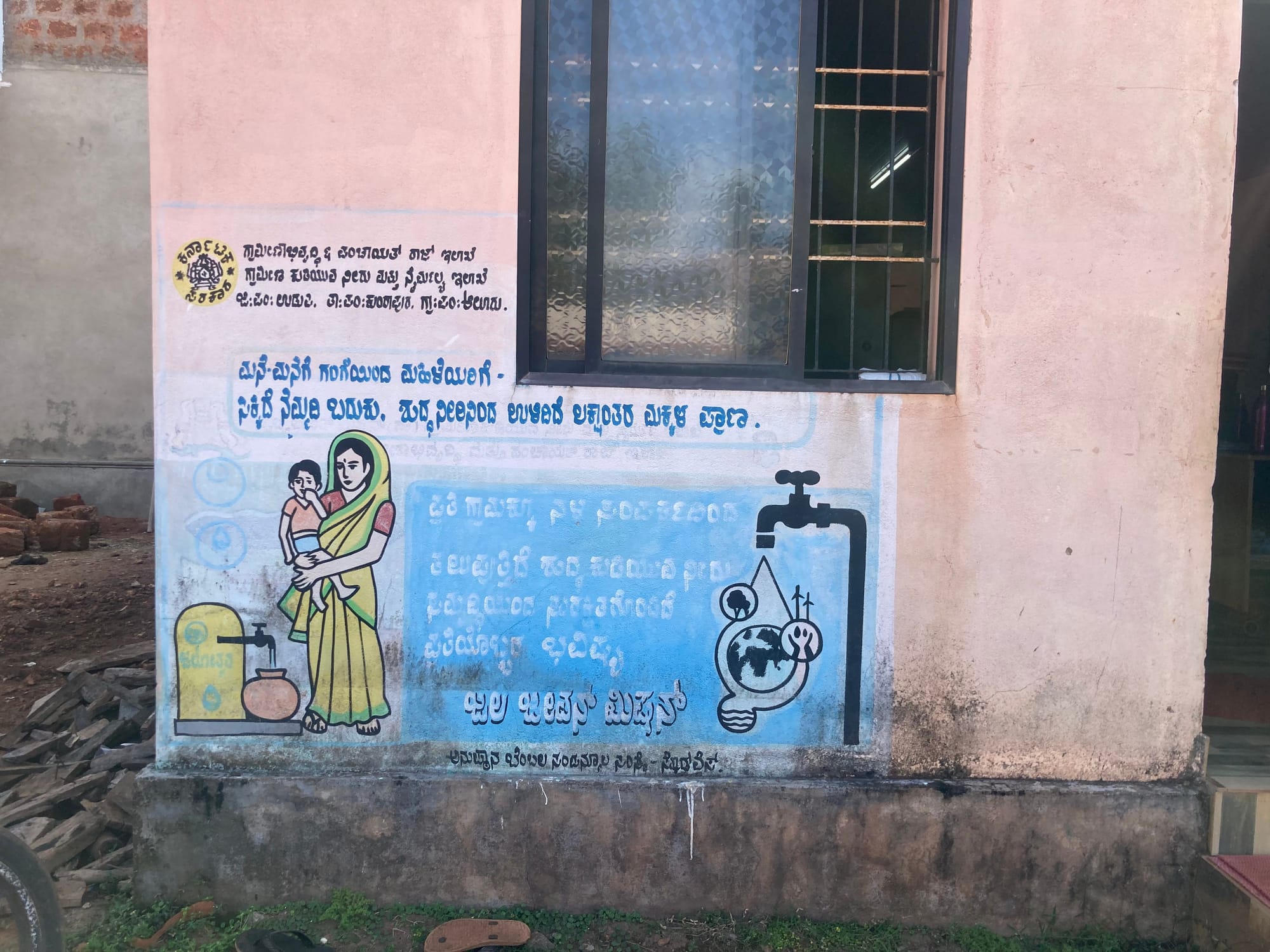
Jal Jeevan Mission, where the implementation is by the State Government, and is maintained by the engineers at the district level for one year and then handed over to the panchayat VWSC for further maintenance. Previously this was managed through the Swajala Dhare (ಸ್ವಜಲ ಧಾರೆ) scheme.
- It consists of a network of Overhead tanks, pipelines and household taps.
Public Water Infrastructure Owned by the GP
Local Water infrastructure planned, built and maintained by the Gram Panchayat fully, through schemes such as NREGA / MNREGA and also SC/ST Development scheme (Ganga Kalyana) are:
- Public Kere
- Public Open Wells and Borewells
- Public Open Wells under SC/ST development Scheme in their localities
- Private Wells
- Private Borewells under SC/ST Development scheme (Ganga Kalyana) in the farms of people belonging to Scheduled Caste and Scheduled Tribes.
Mapping.
Armchair Mapping with the Village Water and Sanitation Committee members.

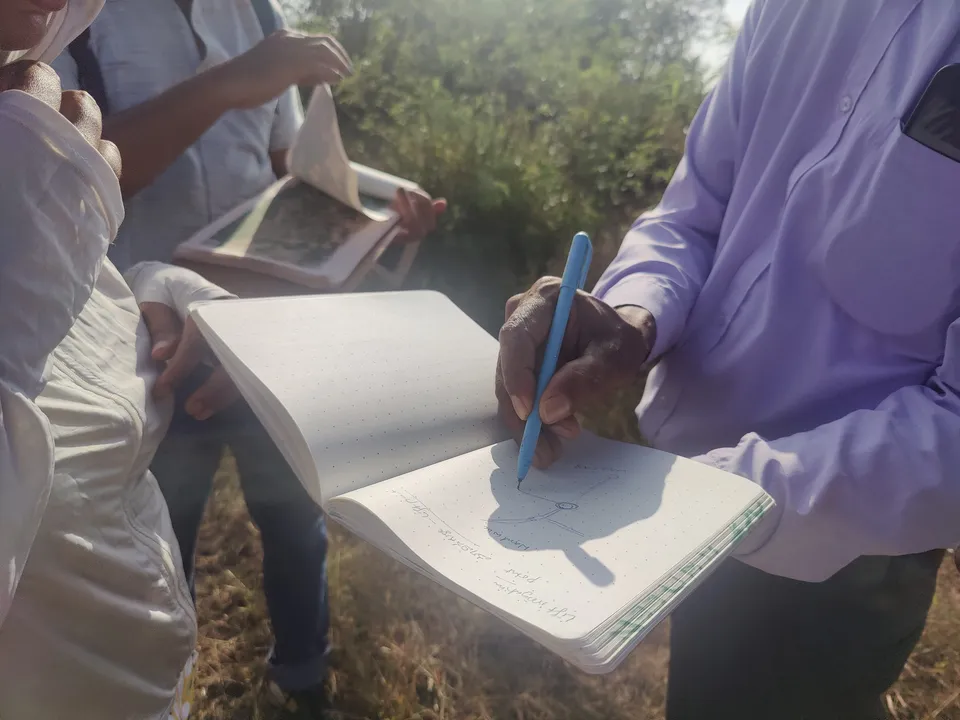
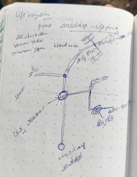
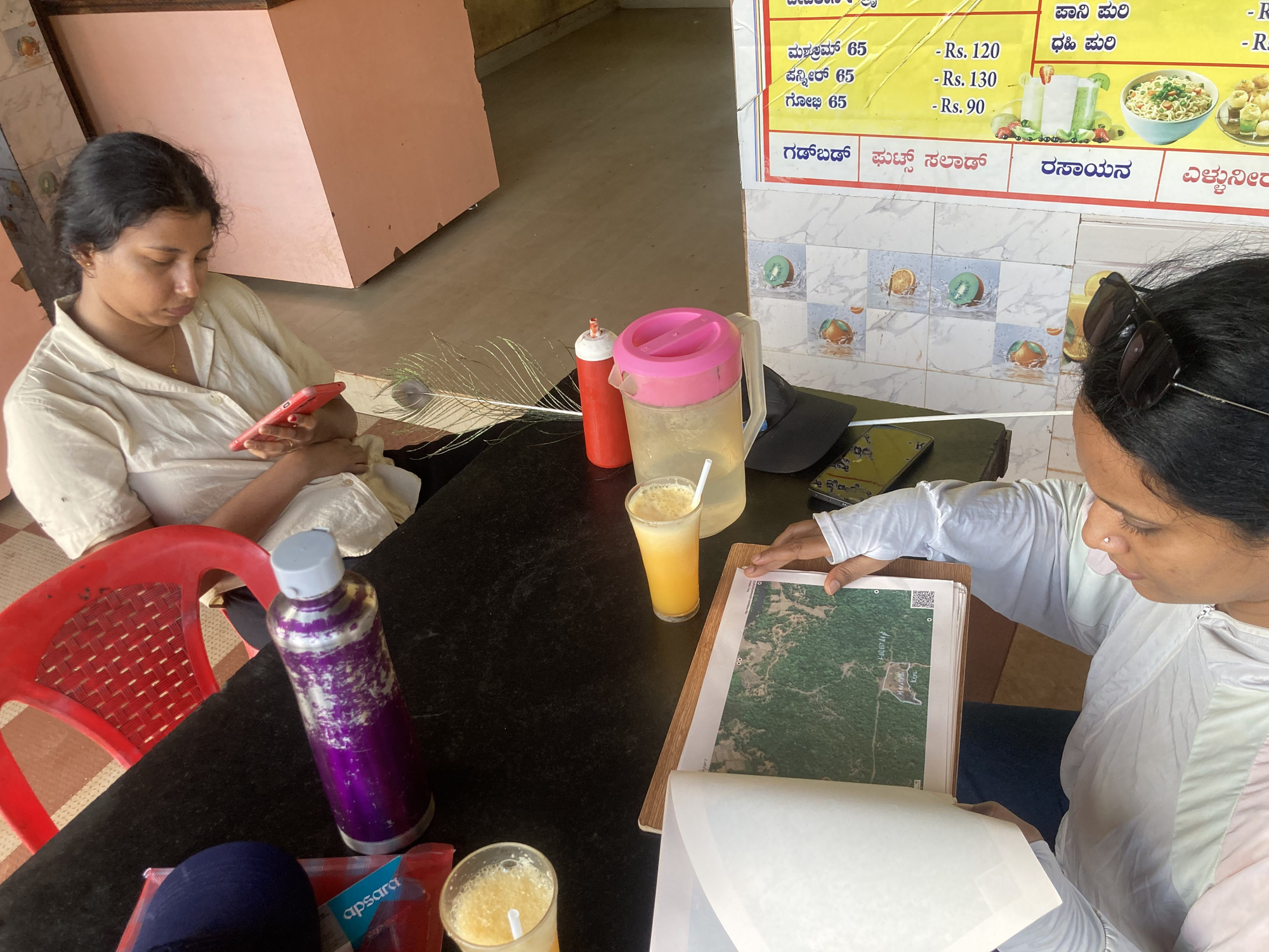
During our conversation with Prashant Kulal and Prasanna Shetty, members of the Aluru and Harkuru VWSC respectively, we located key water systems, mapping them on OSM: The Sowparnika Lift Irrigation Scheme (LIS) Lift Point and the rain-water pond at the erstwhile laterite quarry at Dollabe, and the Hegginekere and Haratatti Kere. We tried to locate Kanikal waterfalls, but we could not do it in OSM. We decided to visit these places within the Aluru village area with Prashant Kulal to map them on OSM.
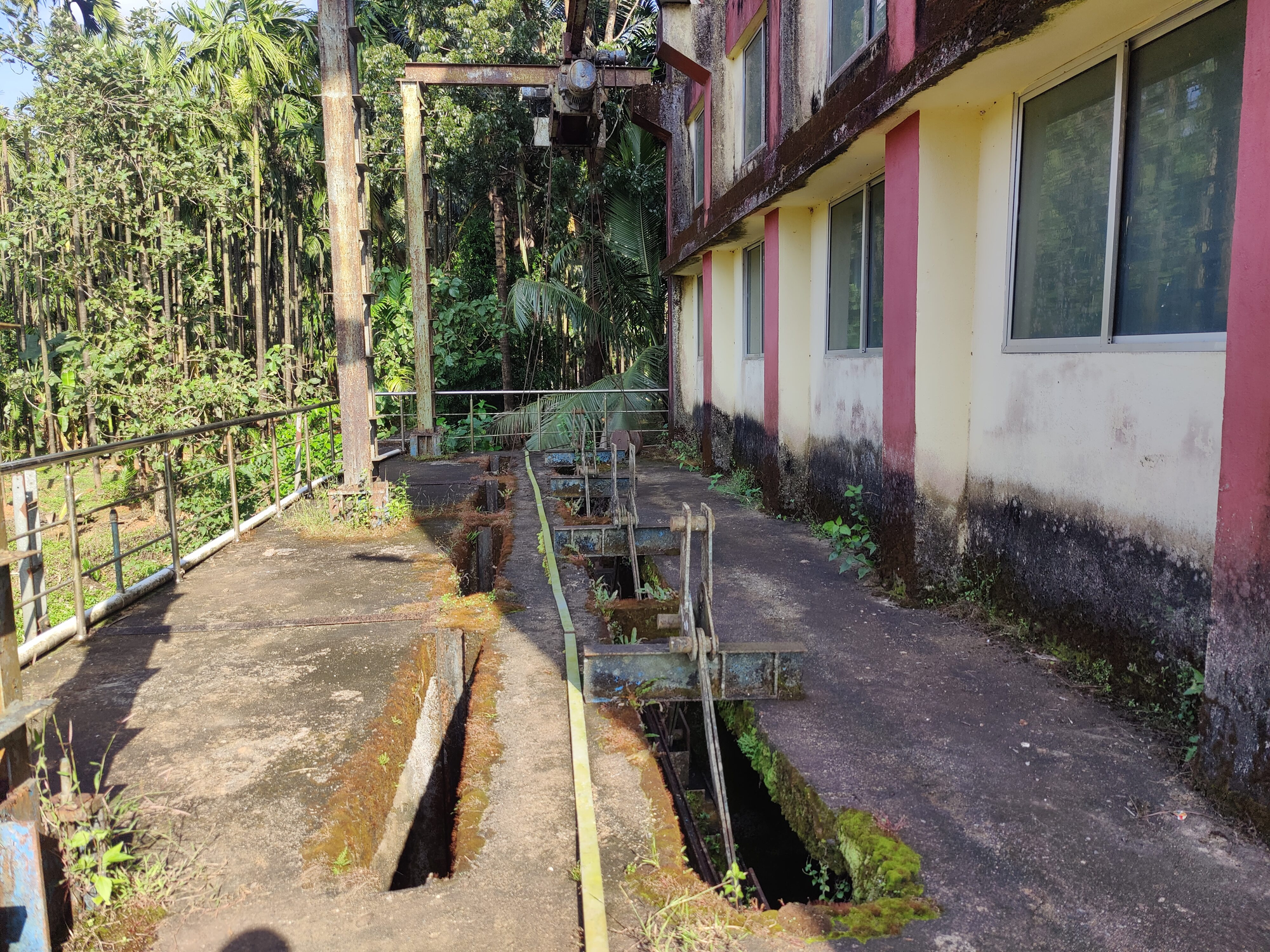
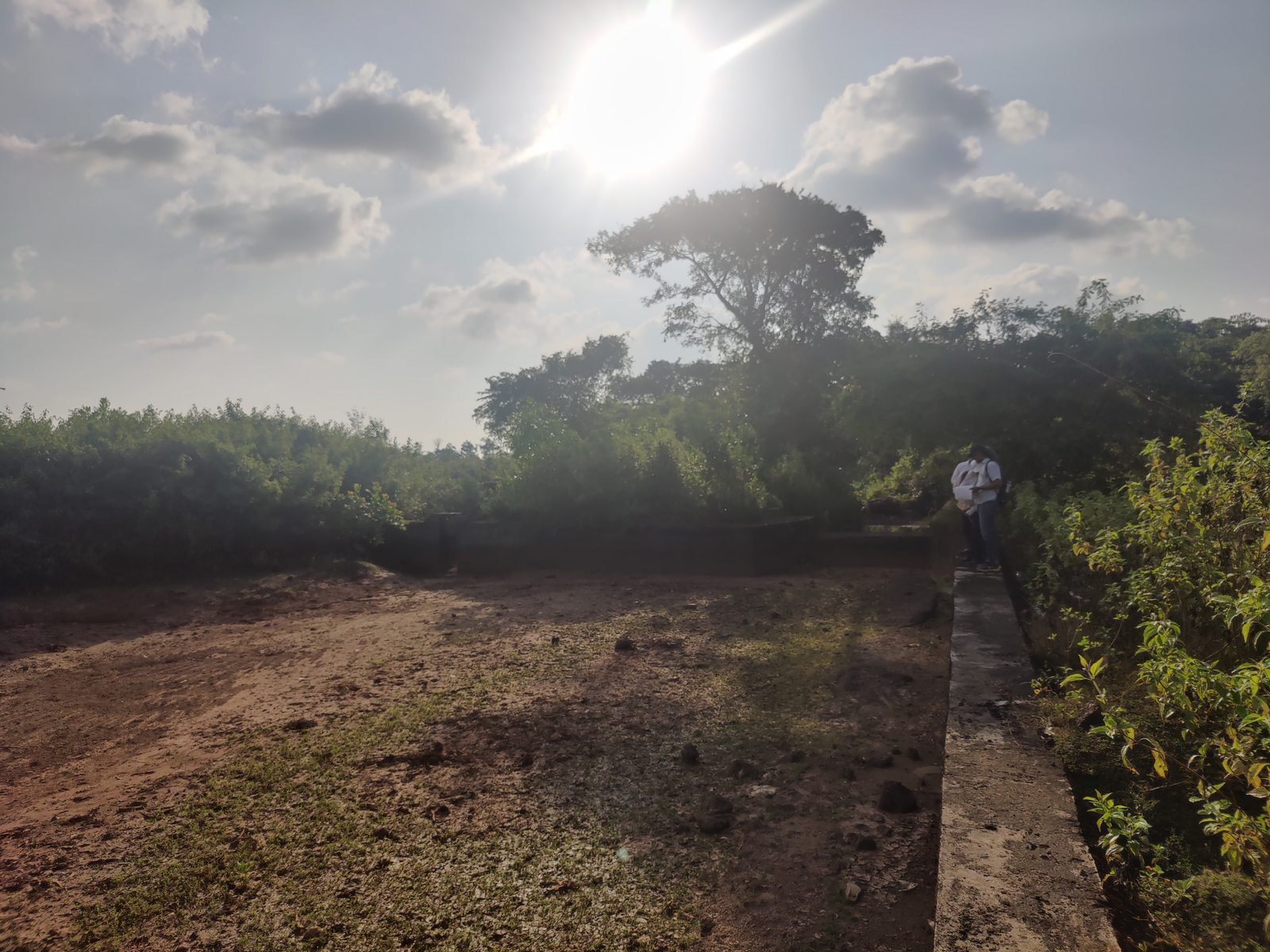
Dollabe: Sowparnika LIS Lift Point.
Type of Structure: Lift Point
Year:
Budget:
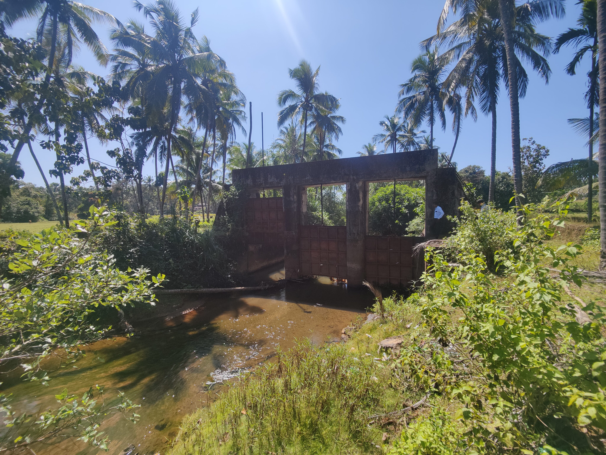
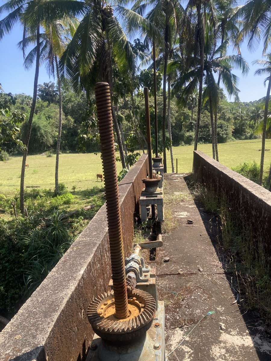
Just south to the Dollabe paare is the lift point of the Sowparnika LIS. The water is pumped from Sowparnika by the pump house to the lift point through an underground pipeline. At the lift point, two sluice gates enable control of water flow into two underground pipelines. The eastern one cuts across Aluru village to feed into ತೋಡ್ thods taking the water across agricultural fields of Aluru. The southern one continues to Nada, Noojadi, and Hakladi.
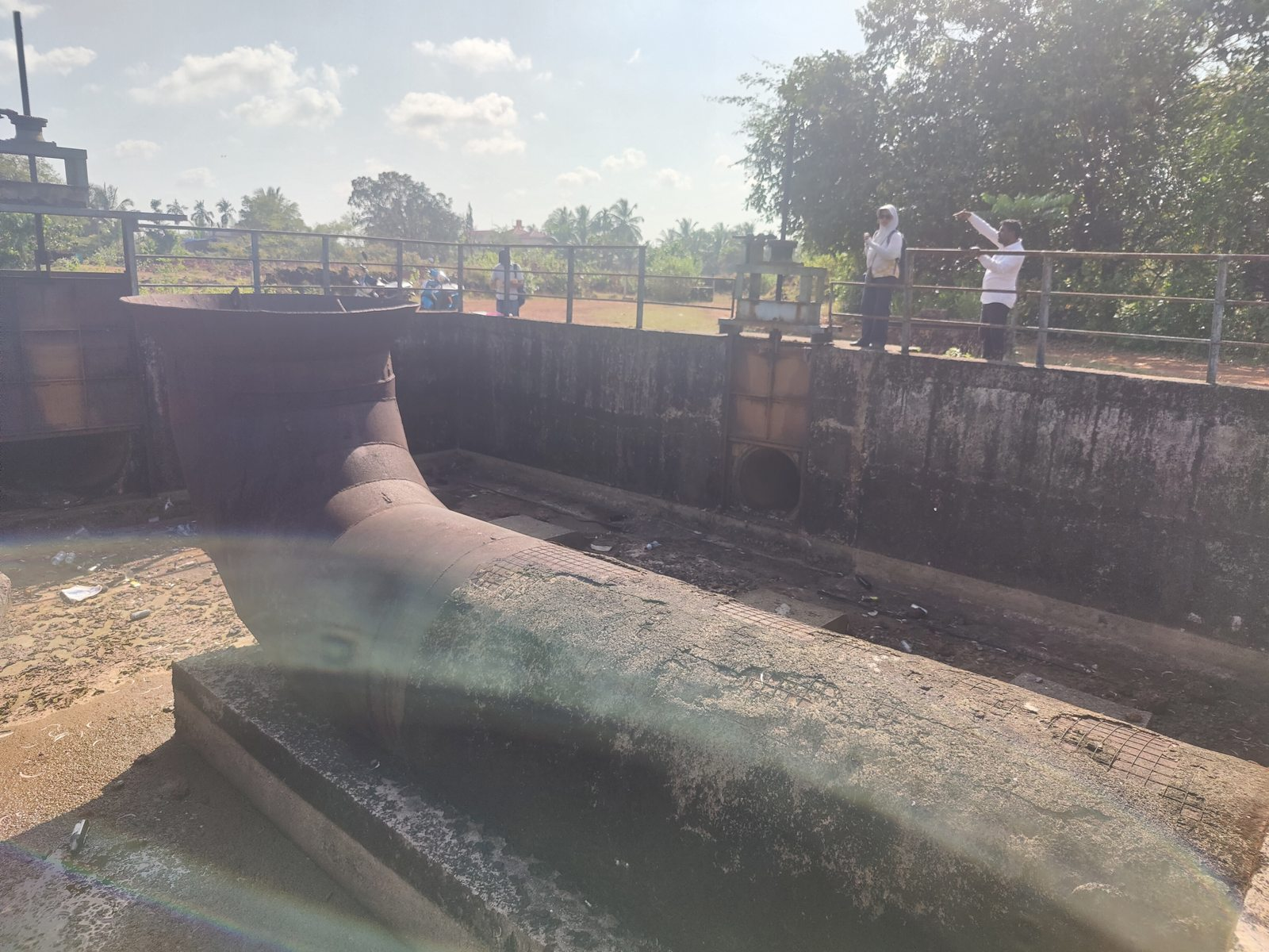
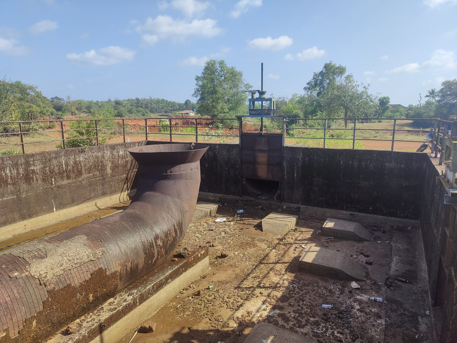
When asked why there is no water being pumped currently, Prashant Kulal told us that as we visited just after the monsoons the fields have enough water. Water from Sowparnika is required when rain water is not enough or has dried up in the catchment ponds etc. He shared that the condition is assessed by the Village Water and Sanitation Committee, which then requests the Irrigation department officials to release water as per the needs of the village.
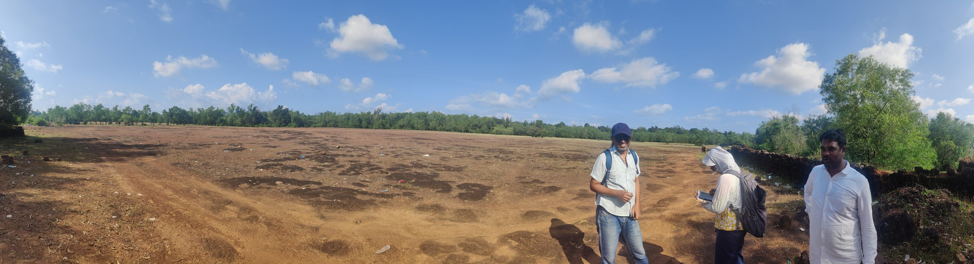
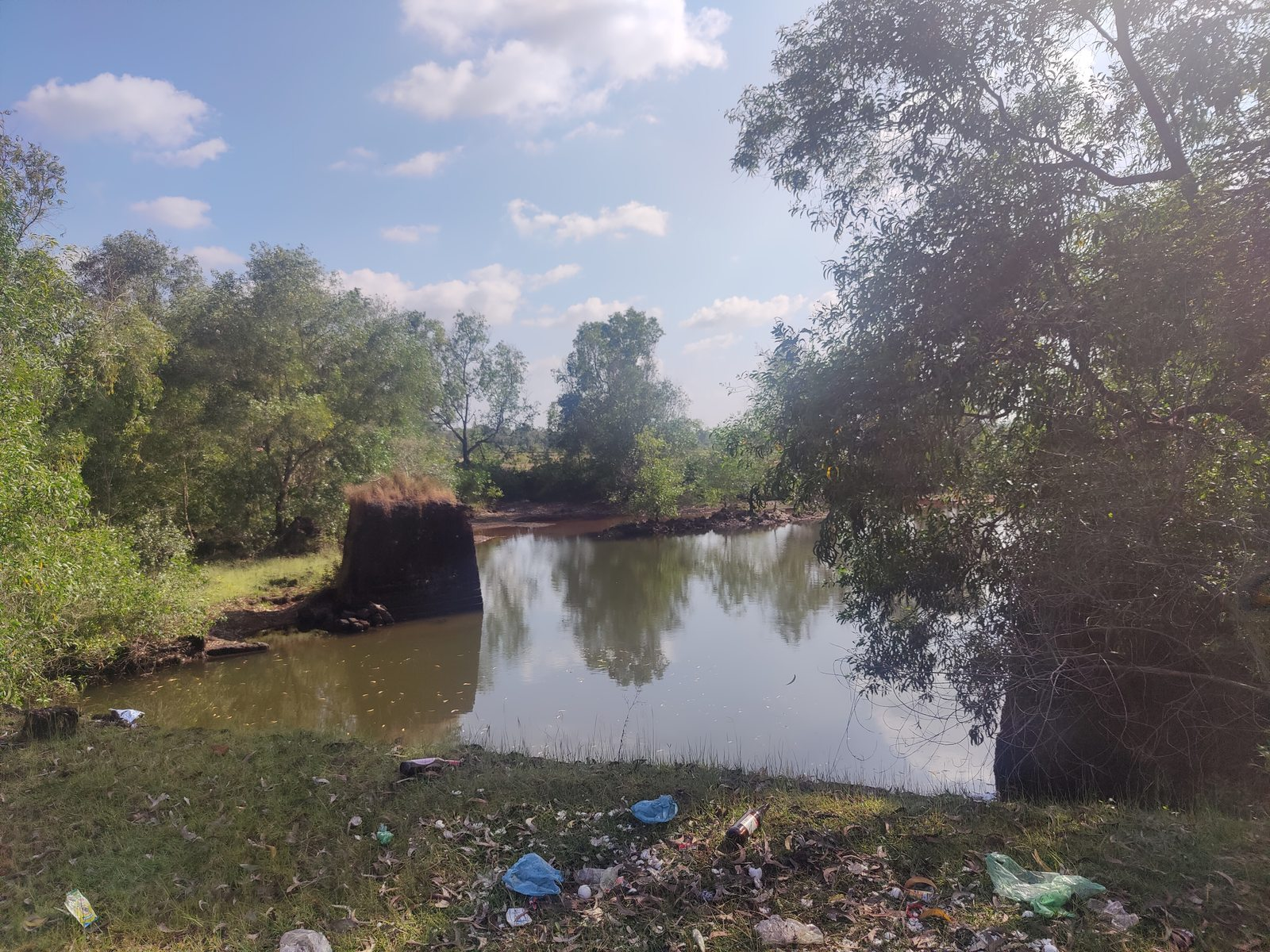
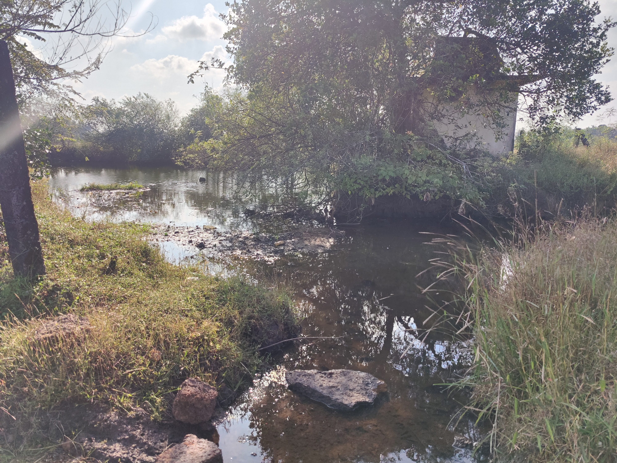
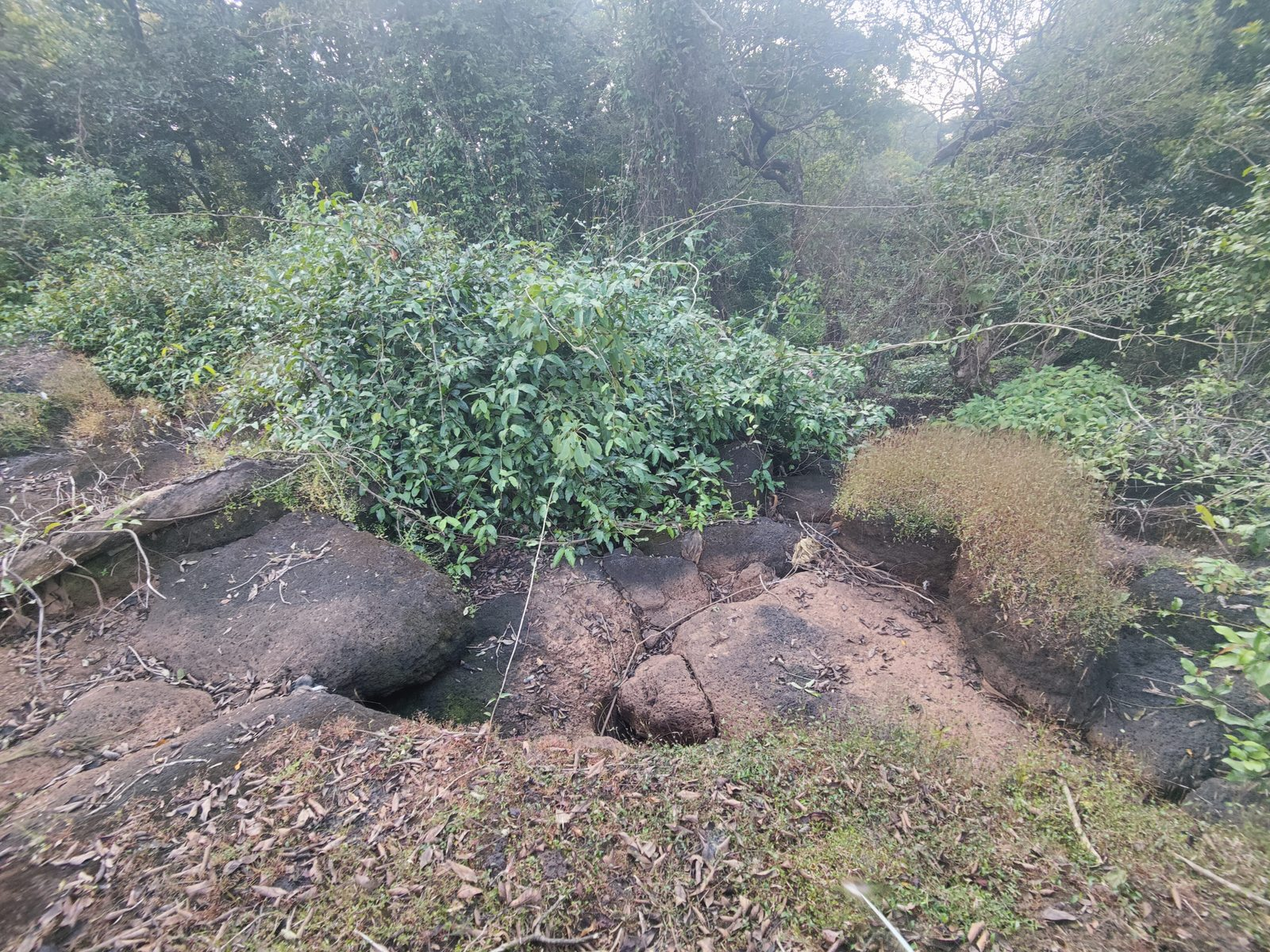
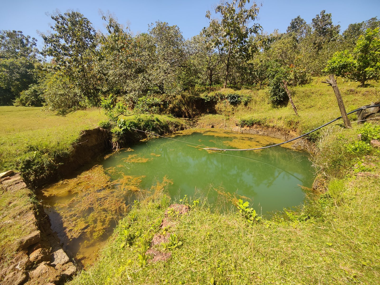
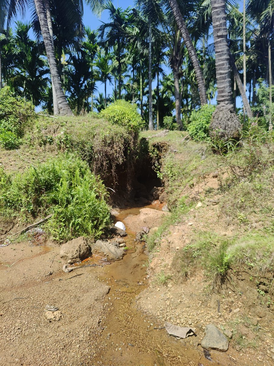
Dollabe: Ponds of Laterite Mine Pits
ಪಶ್ಚಿಮ ಘಟ್ಟ ಮತ್ತು ಅರಬ್ಬಿ ಸಮುದ್ರಗಳ ಮಧ್ಯ ಭಾಗಗಳಲ್ಲಿ ಬರುವಂತ ಪ್ರದೇಶಗಳಲ್ಲಿ ಆಲೂರು ಕೂಡ ಒಂದು, ದಟ್ಟ ಕಾಡಿನ ಪ್ರದೇಶ ಹಾಗೂ ಕೆಂಪು ಕಲ್ಲಿನ ಭೂ ಪ್ರದೇಶ ಇರುವಂತ ಊರು. ಸುತ್ತಾ ಕಣ್ಣಾಡಿಸದರೆ ಕಾಡು ಇಲ್ಲವೇ ಕೆಂಪು ಕಲ್ಲಿನ ಪಾರೆ ಪ್ರದೇಶ. ಆಲೂರು ತಲುಪಬೇಕಾದ್ರು ಹೀಗೆನೇ, ರಸ್ತೆ ಅಕ್ಕ ಪಕ್ಕ ಕಾಡು, ಆ ಕಾಡನ್ನು ಸೀಳಿ ಹೋಗಿರೋ ರಸ್ತೆ, ಮುಂದೆ ಹೋಗ್ತಾ ಇದ್ದ ಹಾಗೆ ಕೆಂಪು ಕಲ್ಲಿನ ಭೂ ಪ್ರದೇಶ, ಅಲ್ಲಿಲ್ಲಿ ಕೆಂಪು ಕಲ್ಲಿನ ಗಣಿಗಾರಿಕೆ ಮಾಡಿದ ಜಾಗಗಳು ದೊಡ್ಡ ದೊಡ್ಡ ಕೆರೆಗಳಾಗಿ ಮಾರ್ಪಟ್ಟು ಕೆರೆನೋ ಸಮತಟ್ಟು ಪ್ರದೇಶನೋ ಅಂತ ಗೋತ್ತಾಗದೆ ಇರೋವಂತ ಜಾಗಗಳು. ಇದೀಗ ಅಡಿಕೆ, ಗೇರು, ಕೃಷಿ ಜೋತೆಗೆ ಜನರು ಕೆಂಪು ಕಲ್ಲಿನ ಗಣಿಗಾರಿಕೆಯಲ್ಲಿಯೂ ಕೂಡ ಹೆಚ್ಚಿನ ಜನ ಅವಲಂಬನೆಗೊಂಡಿರುವಂತ ಪ್ರದೇಶವಾಗಿರುವ ಆಲೂರಿನಲ್ಲಿ ಈ ಹಿಂದೆ ಕೃಷಿ ಚಟಿವಟಿಕೆಗಾಗಿ ನೀರಿಗಾಗಿ ಪರದಾಡುವಂತಹ ಪರಿಸ್ಥಿತಿ ಇತ್ತು ಎಂದರೆ ವಿವರ್ಯಾಸವಲ್ಲ. ಕಾರಣ ಹೆಚ್ಚಿನ ಪ್ರದೇಶಗಳನ್ನು ಅವರಿಸಿದ್ದು ಪಾರೆ. ಪ್ರಾಶಾಂತ್ ಕುಲಾಲ್ ಅವರು ಹೇಳಿದ ಹಾಗೆ ಹಿಂದೆ ನೀರಿನ ಅಭಾವವಿದ್ದು ಜನರು ಕೃಷಿಗಿಂತ ಕೆಂಪು ಕಲ್ಲಿನ ಗಣಿಗಾರಿಕೆಯನ್ನು ಅವಲಂಬನೆಗೊಂಡಿದ್ದರು. ಆ ಸಮಯಗಳಲ್ಲಿ ಗಣಿಗಾರಿಕೆ ಮಾಡಿ ಹಾಗೆಯೇ ಇರುವ ಪ್ರದೇಶಗಳ ಈಗ ಮಳೆ ನೀರು ಸಂಗ್ರಹಣೆಗೊಂಡು ಕೆರೆಗಳಾಗಿ ಮಾರ್ಪಟ್ಟು ,ಇದರಿಂದ ಅಂತರ್ಜಲ ಮಟ್ಟವು ಕೂಡ ಹೆಚ್ಚಾಗಿರುವುದಕ್ಕೆ ಒಂದು ಕಾರಣವಾಗಿರುತ್ತದೆ.
Right next to the Lift Point is an abandoned laterite quarry where rainwater gets stored naturally, which helps increase the groundwater level in Aluru according to Prashant Kulal. He mentioned that while the government spends lakhs to build rain-water catchment ponds in dry areas, they often overlook places such as the abandoned quarries that already hold water.
Mavinaguli Pump House for Sowparnika LIS
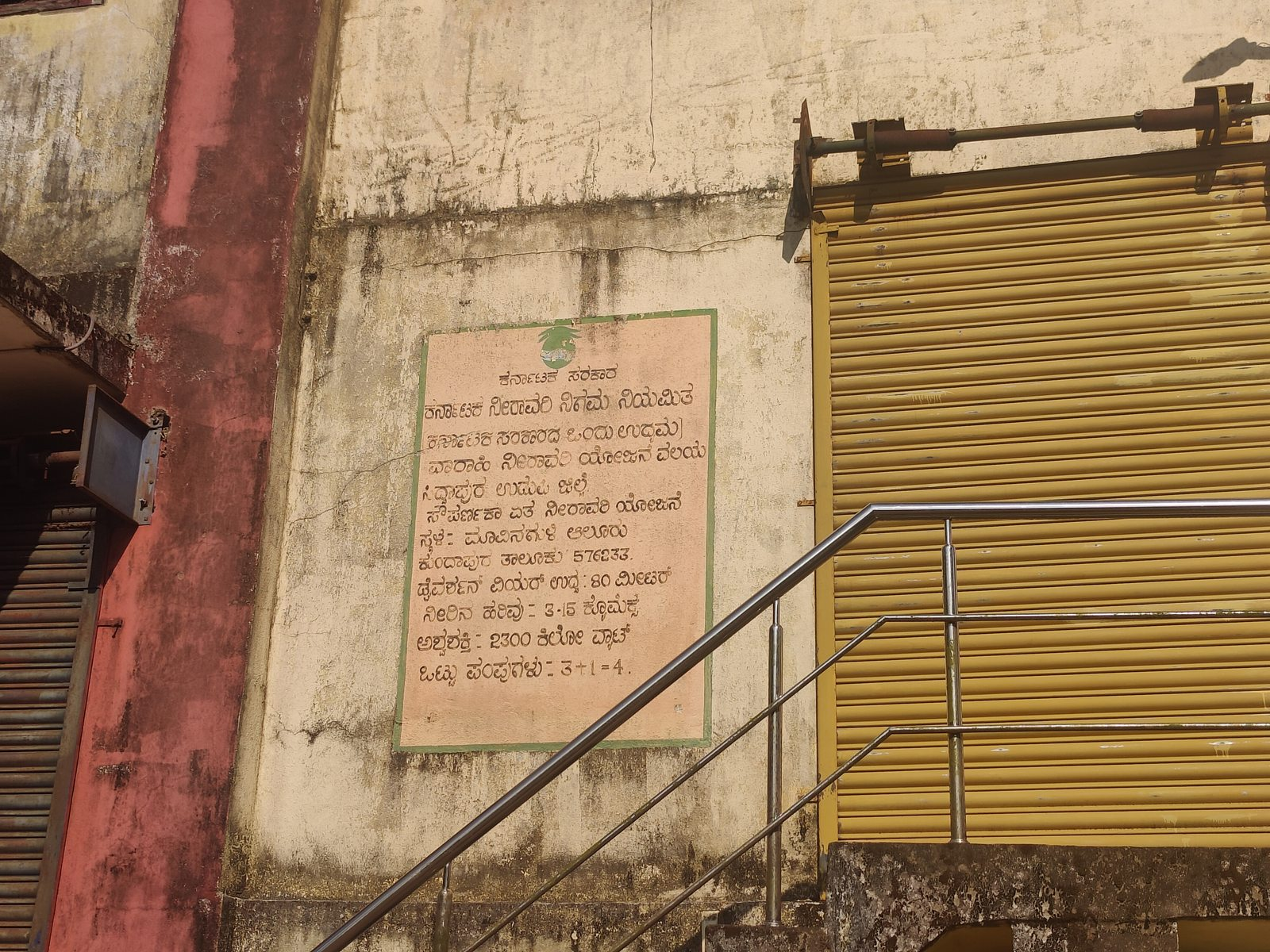
ಸಿದ್ದಾಪುರ ಉಡುಪಿ ಜಿಲ್ಲೆ. ಸೌಪರ್ಣಕಾ ಏತ ನೀರಾವರಿ ಯೋಜನೆ.
- ಸ್ಥಳ: ಮಾವಿನಗುಳಿ ಆಲೂರು, ಕುಂದಾಪುರ ತಾಲೂಕು 576233.
- ಡೈವರ್ಶನ್ ವಿಯರ್ ಉದ್ದ : 80 ಮೀಟರ್
- ನೀರಿನ ಹರಿವು - 3-15 ಕ್ಕೊಮಕ್ಸ್
- ಅಶ್ವಶಕ್ತಿ : 2300 ಕಿಲೋ ವ್ಯಾಟ್
- ಒಟ್ಟು ಪಂಪುಗಳು –3+1=4
Karnataka Irrigation Corporation Limited (a Government of Karnataka enterprise) Varahi Irrigation Project Zone Siddapur, Udupi District Sowparnika Lift Irrigation Scheme.
Siddapur, Udupi District
Sowparnika Lift Irrigation Scheme
- Location: Mavinaguli, Aluru, Kundapura Taluk – 576233
- Type of Structure: Pump House
- Diversion Weir Length: 80 meters
- Water Flow: 3–15 cumecs
- Horsepower / Power Capacity: 2300 kilowatts
- Total Pumps: 3 + 1 = 4
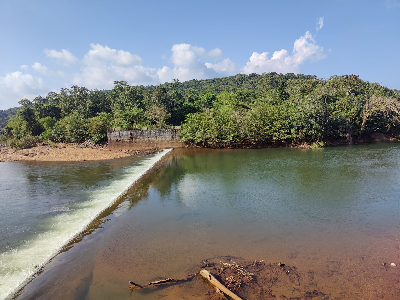
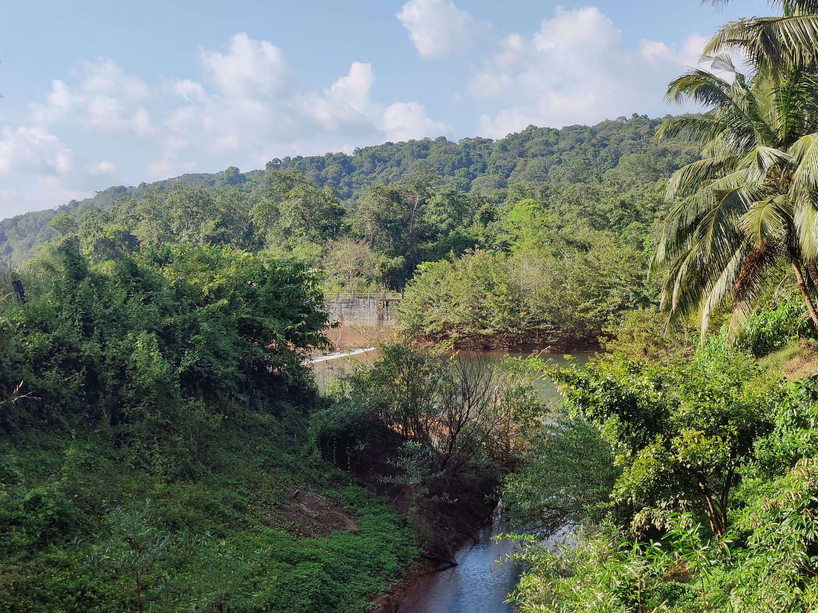
The pump house of Sowparnika LIS is about 1.5 kms straight up north from the Lift Point, in a place called as Mavinaguli. The pump house draws water from the Sowparnika river, where a check dam is constructed to store water during the summers and pump it up for irrigation purposes. This is the main pump house within the Aluru Gram Panchayat, but is maintained by the Irrigation Department. From upstream the river flows water from another check-dam at Iduru Kunjadi–Edurubail, which comes under Iduru Kunjadi Gram Panchayat.
Hegginekere.
- Natural Pond / collection point fed by one of the ತೋಡ್ with water from Sowparnika Lift Irrigation Scheme
Hegginekere is a natural pond that collects rain water, but also is fed by one of the ತೋಡ್ with water from Sowparnika Lift Irrigation Scheme pumped via the lift point. At some point, behind the houses of Aluru village on the Northern side, which we need to ascertain and map, the underground pipeline from the Lift point pours out into an open ತೋಡ್ that weaves its way through the fields to Hegginekere.
Rajesh Devadiga also joined us before we reached Hegginekere. Both Rajesh and Prashant explained how the water from this pond is distributed to three to four surrounding settlements and fields, supporting both agricultural and domestic needs. The pond is surrounded by agricultural fields, and local farmers rely on it for irrigation during the dry season. There is also a small daivasthana dedicated to Bobbarya. People believe that Bobbarya takes a bath in the pond and makes rounds with fire. We spotted many birds in near the pond. From what Sangeetha, who is learning bird-spotting with the help and Anjali, could recall there were quite a few Kites and Red Wattled Lapwings.
In the Karavali region, “Haggu” refers to the summer month. This pond serves as a key water source during that time. Over time, it came to be called Haggina Kere which later evolved into Hegginakere. He also narrated the local names of the twelve months in Kannada. (ಕುಂದಾಪುರ ತಿಂಗಳುಗಳು as they are called here):
ಕೋಡಿ (Kodi), ಹಂಚೋಸಿ (Hanchosi), ಭಾರತ್ (Bharath), ಶಿವರಾತ್ರಿ (Shivarathri), ಸುಗ್ಗಿ (Suggi), ಹಗ್ (Hagh), ಬ್ಯಾಸಗಿ (Byasagi), ಕಾರ್ (Kar), ಆಶಾಡಿ (Ashadi), ಸೋಣಿ (Soni), ಕನ್ನಿ (Kanni), ದಿವಾಳಿ (Divali).
Navagrama Colony Check Dam and Kanikal Waterfalls
Siddapur, Udupi District
Sowparnika Lift Irrigation Scheme.
- Location: Navagrama Colony, Aluru, Kundapura Taluk – 576233
- Type: Bridge, Check-dam, and Holding Pond

Prashant Kulal mentioned how during the rainy season the steam of Kanikal waterfalls is in its full force and local people come there to hike and enjoy the falls. During our visit it was dry; we feel it will be helpful to map the point where the feeder ತೋಡ್ becomes dry during different times of the year.
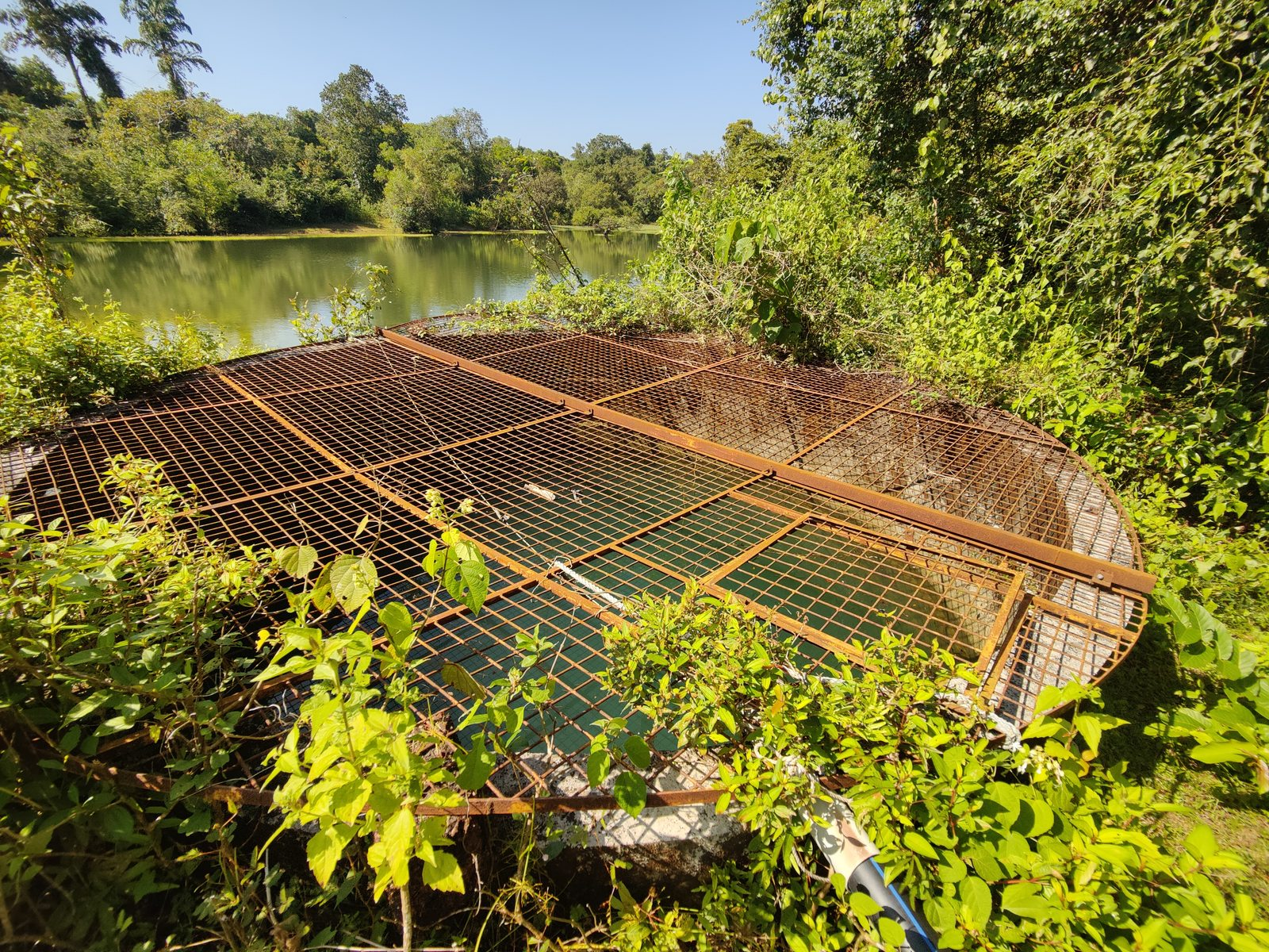
Haratatti Kere
- Owned and maintained by the Forest Department.

Prashant Kulal took us towards slightly northwest from the Navagrama Colony check-dam, to Haratatti Kere. We had already mapped its location and outlines on OSM in the morning. The kere is located amidst a ಪಾರೆ, Paare, surrounded by reserve forest. The water body is owned and maintained by the forest department and is not used for any irrigation or other forms of human consumption.
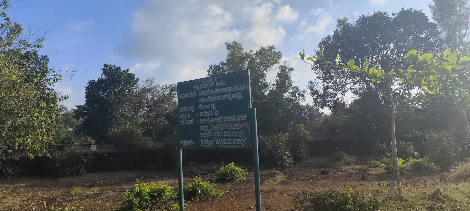
ಜಿಲ್ಲಾ ಪಂಚಾಯತ್ ಉಡುಪಿ
- ಕಾಮಗಾರಿ ಹೆಸರು: ಕುಂದಾಪುರ ತಾಲೂಕು ಆಲೂರು ಗ್ರಾಮ ಪಂಚಾಯತ್ ವ್ಯಾಪ್ತಿಯ ರಿಂಗ್ ರಸ್ತೆ ಅಭಿವೃದ್ಧಿ
- ಅಂದಾಜು ಮೊತ್ತ: ರೂ 5 -00ಲಕ್ಷ
- 321/2022 -23
- ಲೆಕ್ಕ ಶೀರ್ಷಿಕೆ: 2023.2025 ಈ ಸಾಲಿನ ಮಲೆನಾಡು ಪ್ರದೇಶ ಅಭಿವೃದ್ಧಿ ಯೋಜನೆ ಬೈಂದೂರು ವಿಧಾನಸಭಾ ಕ್ಷೇತ್ರ
- ಗುತ್ತಿಗೆದಾರರು: ಸುಕುಮಾರ್ ಶೆಟ್ಟಿ ಆಲೂರು ಕುಂದಾಪುರ
Government of Karnataka
Zilla Panchayat, Udupi
- Name of the Work: Development of the Ring Road within the jurisdiction of Aluru Gram Panchayat, Kundapura Taluk
- Estimated Amount: ₹5.00 lakh
- Work Number: 321/2022–23
- Account Head: Malenadu Area Development Project, Byndoor Assembly Constituency, for the financial year 2023–2025
- Contractor: Sukumar Shetty, Aluru, Kundapura
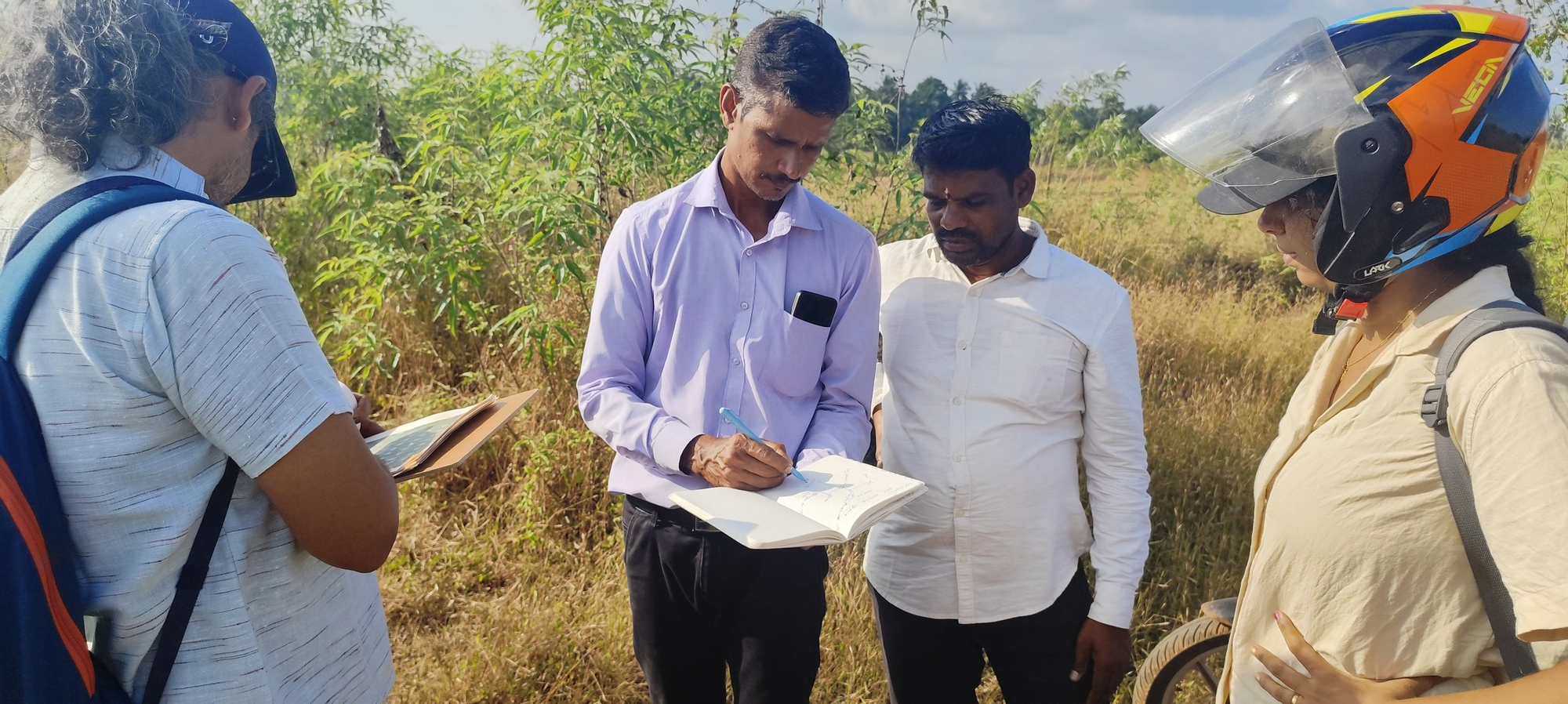
We began the next day, 6th November, with finishing off adding the infrastructure data on OSM and uploading the field papers scans at our Hemmadi Nodal Center. Rajesh then called us to Aluru Panchayat as today’s plan was to map Sowparnika LIS check-dams in Harkuru Village area. As Prasanna Shetty could not give us time, Rajesh decided to take around, and we all left mid-morning in his Wagon R car.
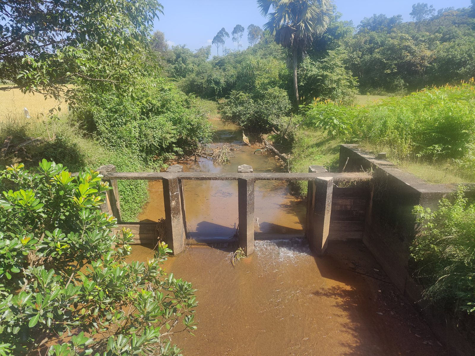
Check Dam 16: Sowparnika Lift Irrigation Scheme, Nadubettu
Siddapur, Udupi District
Sowparnika Lift Irrigation Scheme.
- Name: Check Dam 16
- Type of Structure: Barrage with Sluice Gate
- Stream: Kattinamakki ತೋಡ್ Thod
- Year:
- Budget:
Rajesh Devadiga took us first to the check-dam 16 near Nandikeshwara temple in Harkuru Village area. We parked at the entrance of the temple, and followed Rajesh through the stepped terraces of privately owned farm land. We crossed cashew plants on the highest terrace, to coconut and arecanut ones below, to paddy patches that was harvested. Though we soon lost our way. Rajesh called someone on the phone, and then began making hooting sounds. We heard another hoot from somewhere behind the arecanut grove and finally found the person who would take us to the Check-Dam, Praveen Shetty.
We spent some time cooling down with the clear waters on what was turning out to be a hot day. Sangeetha spotted an Indian wild Hare. Rajesh and Praveen said that a lot of Jinke (Deers) and Wild Boars keep coming here. Praveen showed a patch of agricultural land which was damaged by wild boars and the owners had to leave it unharvested. Rajesh was suggesting Praveen to write a petition to the Forest Department about the loss of crops due to wildlife damage.

Minor Irrigation Check-Dam in Harkuru.
Minor Irrigation Department.
- Minor Irrigation Check-Dam-cum-Barrage.
- Location: Harkuru
- Type of Structure: Check-Dam
Rajesh drove us down the Aluru-Harkuru road, we passed through the village of Harkuru and about 1.5 km before the road enters the jurisdiction of Hakladi Grama Panchayat, we crossed the Kattinamakki ತೋಡ್ Thod. Right beside the bridge the Minor Irrigation department has constructued a check-dam. This check-dam is not part of the Sowparnika LIS, but is part of the work - planned and maintained - by the Minor Irrigation Department.
MNREGA Public Pond next to Kattinmakki Daivadha Mane, Harkuru.
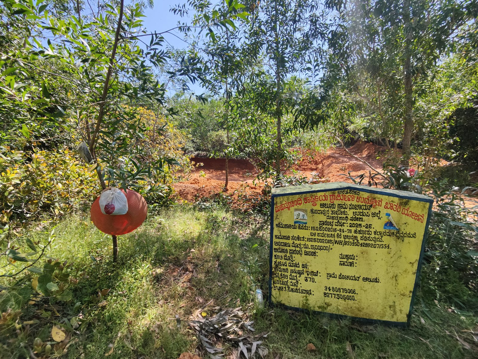
ಮಹಾತ್ಮ ಗಾಂಧಿ ರಾಷ್ಟ್ರೀಯ ಗ್ರಾಮೀಣ ಉದ್ಯೋಗ ಖಾತರಿ ಯೋಜನೆ
ಆಲೂರು ಗ್ರಾಮ ಪಂಚಾಯತ್ ಕುಂದಾಪುರ ತಾಲೂಕು.
ಉಡುಪಿ ಜಿಲ್ಲೆ.
ಮಹಾತ್ಮಗಾಂಧಿ ನರೇಗ.
ಪ್ರಾರಂಭ ವರ್ಷ : 2025-26.
ಕಾಮಗಾರಿಯ ಹೆಸರು: 152,5002015-24-75 ಹರ್ಕ್ಕೂರು ಕಲ್ಯಾನಮಕಿ ದೈವದಮನೆ ಬಳಿ ಸಾರ್ವಜನಿಕ ಕೆರೆ ಅಭಿವೃದ್ಧಿ ಪಡಿಸುವುದು.
ಕಾಮಗಾರಿ ಸಂಕೇತ:1526002016/WH/93393042892071334.
ಅಂದಾಜು ಮೊತ್ತ:ರೂ.5,00000/-
ಕಾಮಗಾರಿ ಪ್ರಾರಂಭ ದಿನಾಂಕ:
ಮುಕ್ತಾಯ:
ಕೂಲಿ ಮೊತ್ತ:
ಸಾಮಾಗಿ:
ಸೃಜಿಸಿದ ಮಾನದ ದಿನ:
ಕಾಮಗಾರಿ ಅನುಷ್ಠದ ಇಲಾಖೆ: ಗ್ರಾಮ ಪಂಚಾಯತ್ ಆಲೂರು.
ದಿನ ಕೂಲಿ ಮೊತ್ತ: 370.
ಒಂಬುಡ್ಸ್ಮನ್: 9480878006.
ಉಚಿತ ಸಹಾಯವಾಣಿ: 39277505000.
Government of India
Mahatma Gandhi National Rural Employment Guarantee Scheme (MGNREGS) Aluru Gram Panchayat,
Kundapura Taluk, Udupi District
Mahatma Gandhi NREGA
- Starting Year: 2025–26
- Name of the Work: 152,5002015-24-75 – Development of the public pond near Harkuru Kalyanamaki Daivamane
- Work Code: 1526002016/WH/93393042892071334
- Estimated Cost: ₹5,00,000/-
- Work Start Date:
- Completion Date:
- Labour Cost:
- Materials:
- Person-days Generated:
- Implementing Department: Aluru Gram Panchayat
- Daily Wage Rate: ₹370
- Ombudsman: 9480878006
- Toll-free Helpline: 39277505000
Rajesh drove us off the Aluru-Harkuru main road, and through a cashew grove. He mentioned that these cashew trees were planted by the Karnataka Cashew Development Corporation (KCDC) in forest land. It were such cashew patches around the Kundapura taluk, among other places along the then Dakshina Kannada district, where the Endosulfan disaster happened over 1980 upto 2000!
We parked next to Rajesh’s sister’s house with a compound wall along a path going through arecanut farms, owned by Rajesh. He took us towards the opposite side to show the work-in-progress of a public pond.

Check Dam 19: Sowparnika Lift Irrigation Project
Varahi Irrigation Project Zone
Siddapur, Udupi District
Sowparnika Lift Irrigation Scheme
- Name: Check Dam 19
- Type of Structure: Bridge and Barrage with 3 Sluice Gates
- Stream: Kattinamakki ತೋಡ್ Thod
- Year:
- Budget:


Thaarikodlu Kere
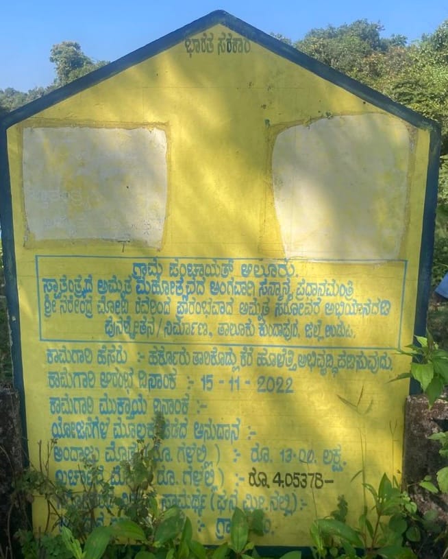
ಸ್ವತಂತ್ರದ ಅಮೃತ ಮಹೋತ್ಸವದ ಅಂಗವಾಗಿ ಸನ್ಮಾನ್ಯ ಪ್ರಧಾನಮಂತ್ರಿ ಶ್ರೀ ನರೇಂದ್ರ ಮೋದಿಯವರಿಂದ ಪ್ರಾರಂಭವಾದ ಅಮೃತ ಸರೋವರ ಅಭಿಯಾನದಡಿ ಪುನಶ್ಚೇತನ/ನಿರ್ಮಾಣ, ತಾಲೂಕು ಕುಂದಾಪುರ, ಜಿಲ್ಲೆ ಉಡುಪಿ.
- ಕಾಮಗಾರಿ ಹೆಸರು - ಹೆರ್ಕೂರು ತಾರೆ ಕೊಡ್ಲು ಕೆರೆ ಹೂಳೆತ್ತಿ ಅಭಿವೃದ್ಧಿ ಪಡಿಸುವುದು
- ಕಾಮಗಾರಿ ಆರಂಭ ದಿನಾಂಕ :- 15 - 11 - 2022
- ಕಾಮಗಾರಿ ಮುಕ್ತಾಯ ದಿನಾಂಕ :-
- ಯೋಜನೆಗಳ ಮೂಲಕ ಪಡೆದ ಅನುದಾನ :-
- ಅಂದಾಜು ಮೊತ್ತ ರೂಗಳಲ್ಲಿ: 13.೦೦ ಲಕ್ಷ
- ಖರ್ಚಾ ದ ಮೊತ್ತ ರೂಗಳಲ್ಲಿ: 405378 /-
Gram Panchayat Aluru
Under the Azadi Ka Amrit Mahotsav initiative launched by the Honourable Prime Minister Shri Narendra Modi, the rejuvenation/construction of lakes under the Amrit Sarovar Abhiyan, Kundapura Taluk, Udupi District.
- Name of the Work: Desilting and development of Harkuru Thaare Kodlu Pond.
- Work Start Date: 15-11-2022
- Work Completion Date:
- Grant Received Through Schemes:
- Estimated Amount (in Rupees): ₹13.00 lakh
- Expenditure Incurred (in Rupees): ₹4,05,378
The Thaare Kodlu kere is a natural pond, which is fed by natural streams through the forested area. It is located in reserve forest land. It has been de-silted and developed using the budget allotted under the Amrit Sarovar Abhiyan in 2022.

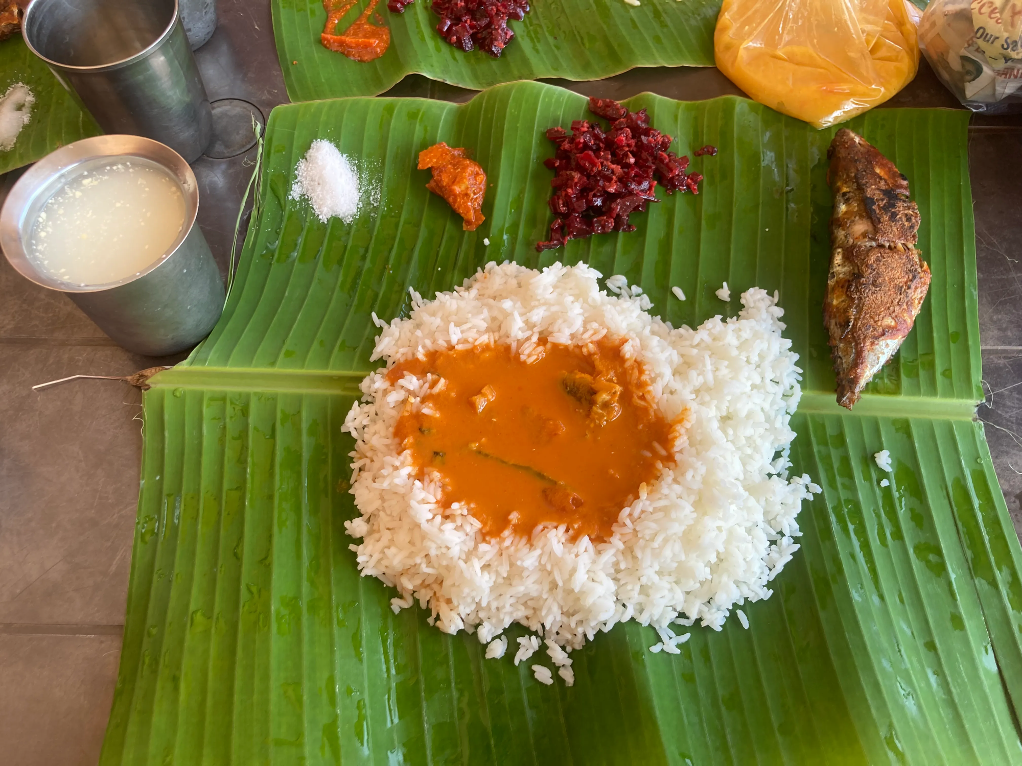
We could not stay back to explore more of the ThaareKodlu Kere and the public well, as it was getting late for Rajesh and our fish meals was getting cold.
What Next?
Over these two days we felt we had just about begun to scratch the surface of the multiple water-systems of the Aluru Grama Panchayat. Through the two days with Rajesh and the other members of the VWSC we discussed quite a few possibilities. We both could get a glimpse of what mapping the system components would look like, and could mean for the day to day workings of the Panchayat Office.
We saw the possibility of mapping of the actual flows of all the inter-connected ತೋಡ್ thods for irrigation purposes, as well as the possibilities and requirements of mapping the network of pipelines and overhead tanks of Jal Jivan Mission. We also discussed the need to map the flow of water at various seasons at each of these points. What got us excited is the opportunity to understand and learn more closely about how a Panchayat, as a the first and the most direct level of self-governance unit, works.
We are taking this work forward along two inter-linked paths:
- Continued Participatory Mapping to Support Participatory Decision Making
- Co-Learning about Panchayat System of Governance of Water Systems through Critical Making.
Continued Participatory Mapping: A Series of In-Situ Map-a-thons
We discussed with Rajesh the idea of local in-situ map-a-thons with the elected GP members, other members of the VWSC, Aluru’s high school children, and also open it for anyone interested from the place. We will be planning a series of monthly sessions from January 2026.
Our current mapping of not only the location and the public information, but also the images, notes and stories will be fed into and displayed through the Participatory Geo-Spatial Laboratory’s (PGSL) interface. The ongoing mapping will also add into the map on PGSL, through which we will create a public dashboard that can feed into multiple ways that decisions are taken for water governance in the Aluru Panchayat area.
Learning Course on Understanding Panchayat: 18, 19, 20 December
We, via the School for Community Wellbeing of the Living Labs Institute, will offer a three-day course under the series of Making to Understanding Panchayat on the 18, 19, 20 December. The mode of learning will be make-a-thon, where we will facilitate groups of learners, coming from outside the place, to critically and collaboratively make mock-ups and prototypes supporting local self-governance of water systems. The map co-produced with the communities and members of the VWSC, and the Panchayat will be the base for the learners to imagine, make and explore possibilities. Through the three days we will learn about how governance works in a Village Panchayat, with a specific focus on governance of water systems. Key provocations that emerged from our attempt to map the water systems of Aluru on the 5 and 6th November are:
- What are and could be the static and dynamic forms of information linked to water systems that could support ongoing practices of local self-governance of water?
- What are the ways and forms so that static & dynamic information can be added to, annotated and analysed by the local communities and stakeholders across departments?
- What forms a public dashboard could take to help local communities and stakeholders across departments navigate and negotiate with their different matters of concerns of water governance?
Join us on 18, 19, 20 December 2025, to learn with and in Aluru Panchayat, through mapping & making.